The town of Călărași benefits from the opening of the Borcea Canal of the Danube as well as the “steel” canal belonging to the former Siderca platform, now demolished. These local heritage values, both of nature and of the recent past, are present on site, but very little used and having no impact on the community life quality. The limit of the urban fabric towards the south is partially free of constructions and partially landscaped (Central Park, Zoo Garden, community gardens), a possible green axis but not yet established, because many of the spaces that could be green and landscaped for the promenade and relaxed are abandoned or in a very bad condition. However, these lands are included in the city’s development plan (PUG) as green spaces, and in the city’s strategies, as objective of improving public green spaces and pedestrian areas.
At the same time, another local heritage value, linked to the identity of the city of Calarasi, needs to be better highlighted, being linked to the green spaces in this area: it is about the monumental metal statues made in the 90s, following a sculpture camps, the artists reusing the metal from the former demolished halls of the steel industry and having poetic names (the chopper of dreams, the chariots of the gods, etc.)
The Action Plan for Calarasi (”The Green Urban Axis” ) aims at reconnection of the urban gardens and various types of green (or not yet green) spaces located along the Borcea water banks, valorization of ex- industrial sites for leisure and eco-tourism. Also, ”The Green Urban Axis” of Călărași will include and valorize the existing metal statues (modern abstract sculptures) as symbolic heritage of the post-industrial era, making them more visible and relevant in relation to pedestrian and bicycle routes.
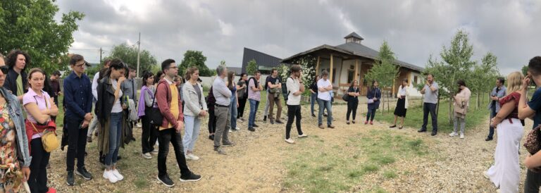
The Action Plan for Călărași (”The Green Urban Axis” ) started at the suggestion of the local stakeholders (the director of the City Museum), and was verified by several interviews taken by the students from the faculty of Urbansim of Ion Mincu University to the local residents. It was presented to the mayor of the city and several simulations of landscape projects for green areas were developed by the students from UAUIM, and presented during the international workshop that took place in June 2022 in Calarasi.
The main activities within this Action Plan are:
- Investigating the existing situation, terrain studies, measurements;
- Re-activating the local interest for the Borcea canal green spaces and its potential for tourist development and leisure activities;
- Designing the Master-plan for spatial-functional organization of public green spaces on Borcea canal area în Cālărași; and
- Presenting the Master Plan and debating it with the local authorities as a basis for a future feasibility study.
The interest shown by the local community for the action plan was quite good, but there is room for improvement in this interaction between the expertise, visions and plans that the university can offer to the city, as elements of stimulation, and the more active involvement of citizens and local authorities in relation with the huge potential of city’s green heritage for revalorization and re-use.
The action plan was also accompanied by a related action aimed at the generation of high school students living in Cālărași, who participated in a photography contest organized by UAUIM on the theme of landscape and heritage, prizing the best photographies and put them into direct contact with the prestigious values of our university; through this we realized a knowledge transfer and education of a group of children in the spirit of attachment to the city where they live.
The action related to the photography contest for students with the theme ”Landscape and Heritage for Community” will be promoted annually, through the involvement of the community center Poșta Veche from Călărași. The students from UAUIM together with the students will discover the city together, and the photos will be the basis for debating ideas and visions of urban development.
The masterplan for the Green Urban Axis is still in the works and requires some revisions based on topographical data that have been delayed, but it is started, and we hope to complete it, to stage together with the municipality the interventions. This document aims to become the basis for an application for financing, and could be followed, for some investments, by necessary feasibility studies.


